Lower Dolpo Trek

- Breakfast
- Lunch
- Dinner
- Hotel
- Lodge
- Teahouse
- Camp
- Trekking
- Camping
- Sightseeing
- Autumn
- Spring
You can talk with our travel experts for departure dates and price details.
- Private trip departures everyday
- No hidden cost
- Local based company
- We can help for big group
- Over 17 years of experience
- According to your needs, we can Customize the itinerary.
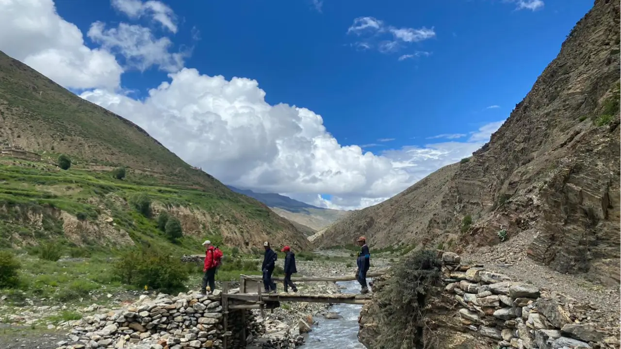
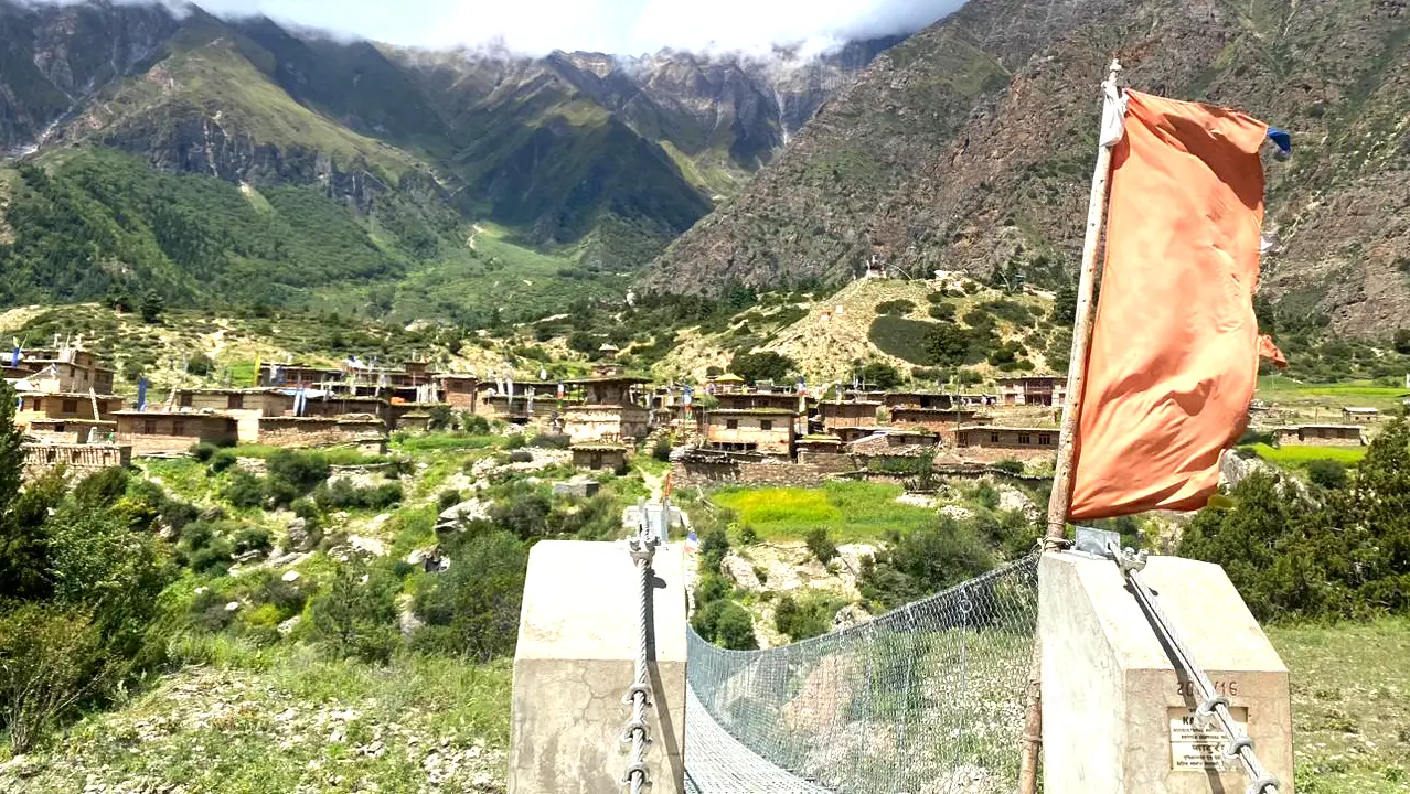
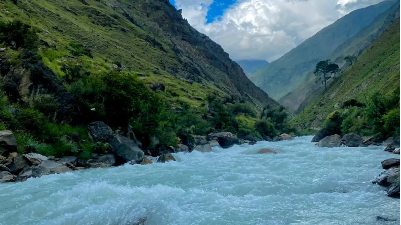
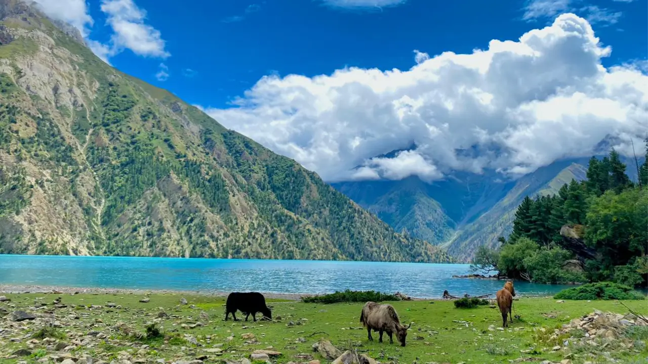
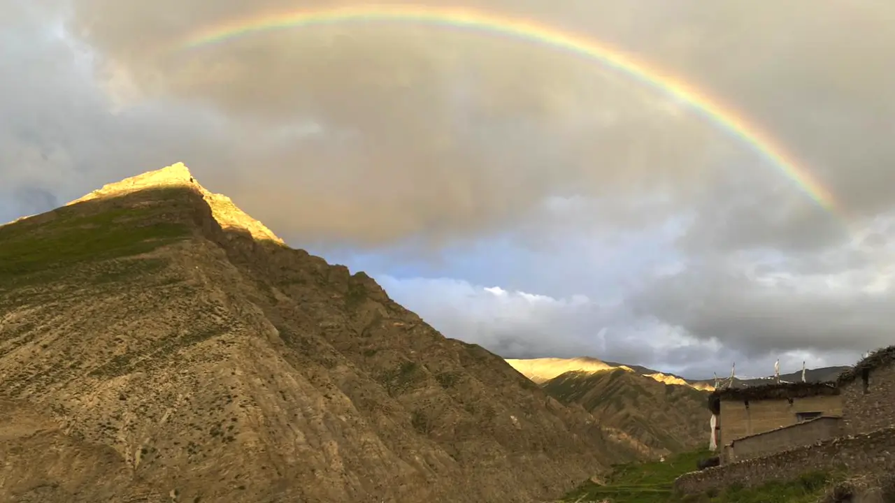
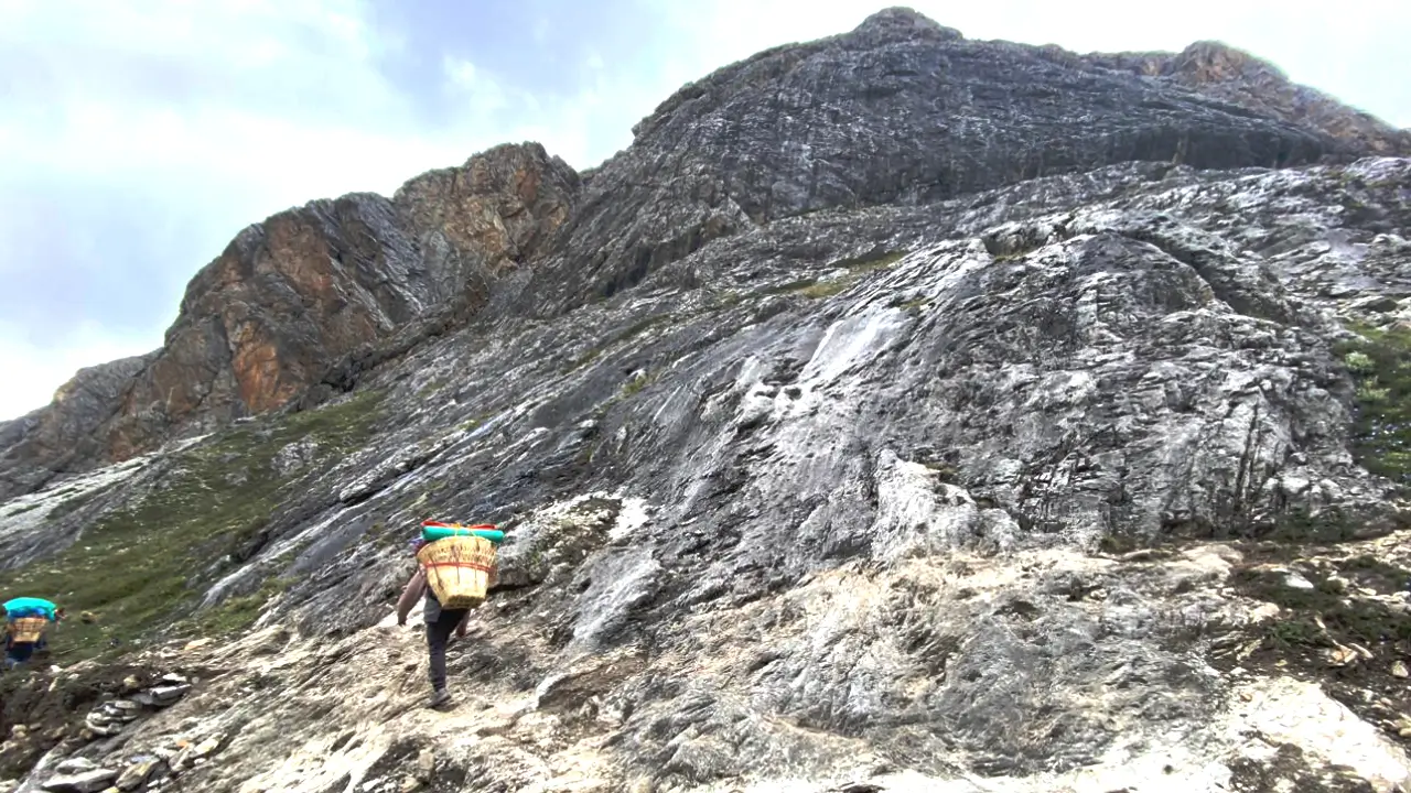
Lower Dolpo Trek Photo Gallery
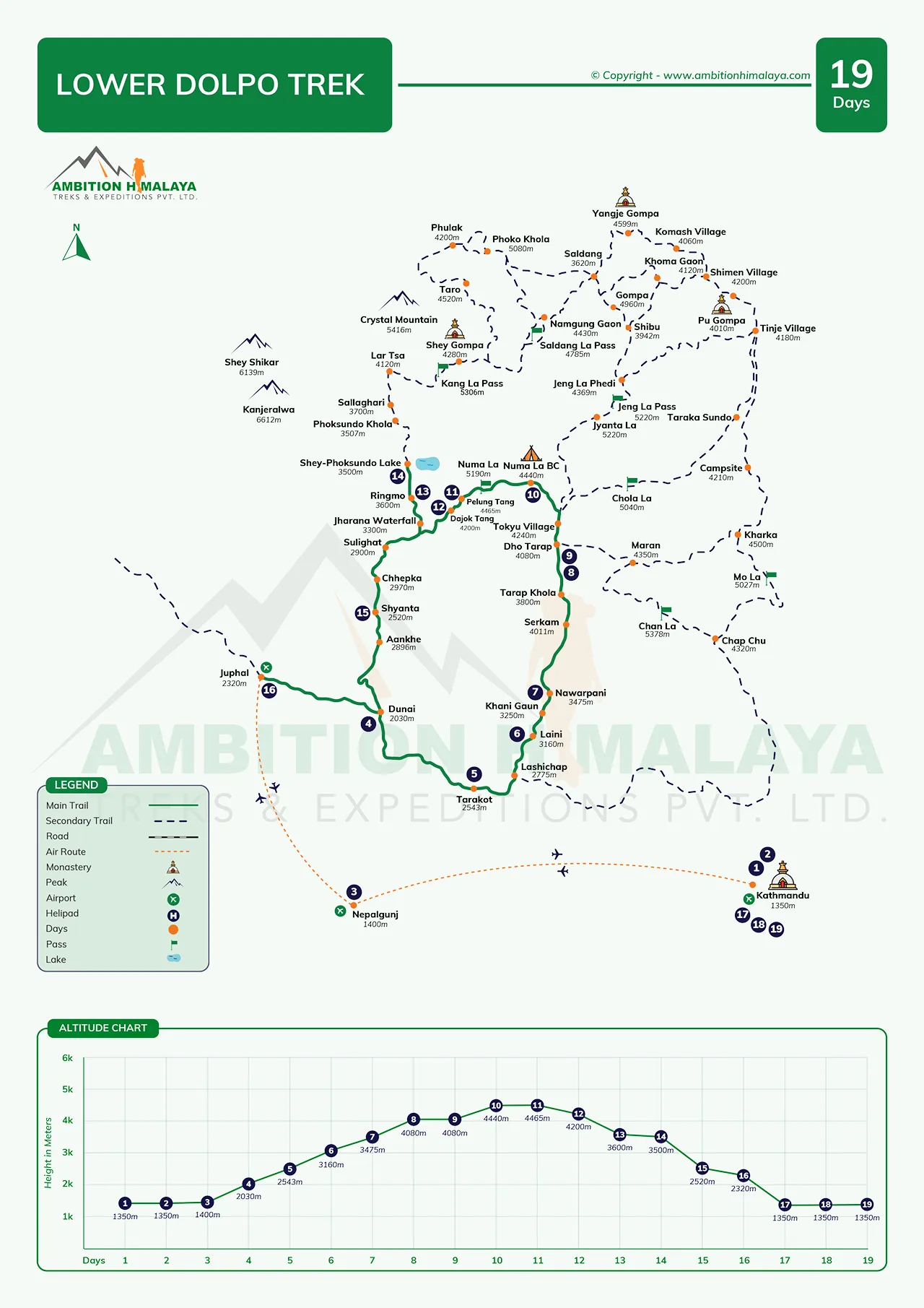
Itinerary of Lower Dolpo Trek
| Day | Mode | Route Itinerary | Elev.(m) | Duration | Overnight | Included |
|---|---|---|---|---|---|---|
| 01 | Fligh | Arrival in Kathmandu | 1,300 | 30m | Hotel | Dinner |
| 02 | Restday | Trek permit preparation and rest day | 1,300 | ..... | Hotel | Breakfast |
| 03 | Flight | Kathmandu - Nepalgunj flight | 150 | 1 hour | Hotel | Breakfast |
| 04 | Fly/trek | Flight from Nepalgunj to Juphal and trek to Dunai | 2,850 | 4/5 hrs | Guesthouse | B L D |
| 05 | Trek | Dunai to Tarakot | 2,543 | 6/7 hrs | Guesthouse | B L D |
| 06 | Trek | Tarako - Laini | 3,160 | 6/7 hrs | Tea house | B L D |
| 07 | Trek | Laini - Nawarpani | 3,545 | 5/6 hrs | teahouse/camp | B L D |
| 08 | Trek | Nawarpani - Dho Tarap | 4,090 | 7/8 hr | teahouse/camp | B L D |
| 09 | Restday | Acclimatization Day in Dho Tarap ( Visit beautiful vlllage | 4,090 | ..... | Teahouse/Camp | B L D |
| 10 | Trek | Trek from Dho Tarap - Numa La Base Camp | 4,440 | 6/7 hrs | Teahouse/Camp | B L D |
| 11 | Trek | Numa La Base Camp - Pelung Tang via Numa La Pass | 5,190/4,465 | 6/7 hrs | Teahouse/Camp | B L D |
| 12 | Trek | Penung Tang to Dajok Tang via Baga La Pass | 5,070/4,080 | 6/7 hrs | Teahouse/Camp | B L D |
| 13 | Trek | Trek from Dajok Tang - Ringmo | 3,600 | 4/5 hrs | Teahouse | B L D |
| 14 | Trek | Ringmo to Phoksundo Lake & Visit Phoksundo lake and looking surrounding beautiful place | 3,661 | ..... | Teahouse/Camp | B L D |
| 15 | Trek | Phoksundo - Shyanta | 2,520 | 7/8 hrs | Guesthouse | B L D |
| 16 | Trek | Shyanta - Juphal | 2,320 | 7/8 hrs | Guesthosue | B L D |
| 17 | Flight | Juphal - Nepalgunja and flight to Kathmandu | 1,300 | 4/5 hrs | Hotel | B L |
| 18 | Free/rest | Today is buuferday and free day | 1.300 | ...... | Hotel | Breakfast |
| 19 | Flight | Departure From Kathmandu | ..... | ..... | .... | Breakfast |
Includes/Excludes
What's included
- All the required airport and hotel transfers by private vehicle
- Twin-sharing accommodation in Kathmandu wit 3 star hotel and breakfast
- Your Kathmandu to Nepalgunj and Nepalgunj Flight als for guide
- Your flight Nepalgunj to Juphal and Juphal to Nepalgunj Flight along for guide as well.
- Tea House/Home Stay/tent accommodation during the trekking days in the mountain
- Full board standard meals (Breakfast, Lunch, and Dinner) with 3 cup of hot drinks per day during the trek
- Government license holder trekking guide and with his expenses and Insurance
- Necessary porter during trekking with their expenses and Insurance
- Special trekking permit of Shey Phoksundo National Park and local taxes
- Food/Salary/accommodation and medical or accidental insurance for all the trekking staff
- Ambition Himalaya Treks Medical kit bag
- Farewell dinner after the trip completion in Kathmandu.
- All the government and local taxes
- Ambition Himalaya duffle bag
- Achievement Certificate from Ambition Himalaya Trek as gift for your success
Optional Addons
(Available addons on extra cost)
- Deluxe hotel in Kathmandu
- World heritage sites tour in Kathmandu
What is excluded
- International airfares, Travel/medical insurance, and Nepal entry visa fees.( Visa fee: 15 days 30 USD . 30 Days 50 USD )
- Emergency rescue by helicopter or Evacuation etc.
- Your travel Insurance
- Extra night hotel Nepalgunj due to bad weather and earlier back to Kathmandu
- Riding horse along the trek
- Alcoholic beverages, bottle mineral water, soft drinks, and snack foods Hot showers and Extra tea coffee and
- Gratitude for the guide and porters
Route Map & Altitude Chart
Trip Information
Difficulty & Fitness for Lower Dolpo Trek
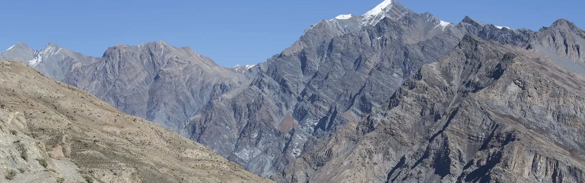
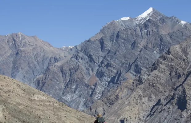
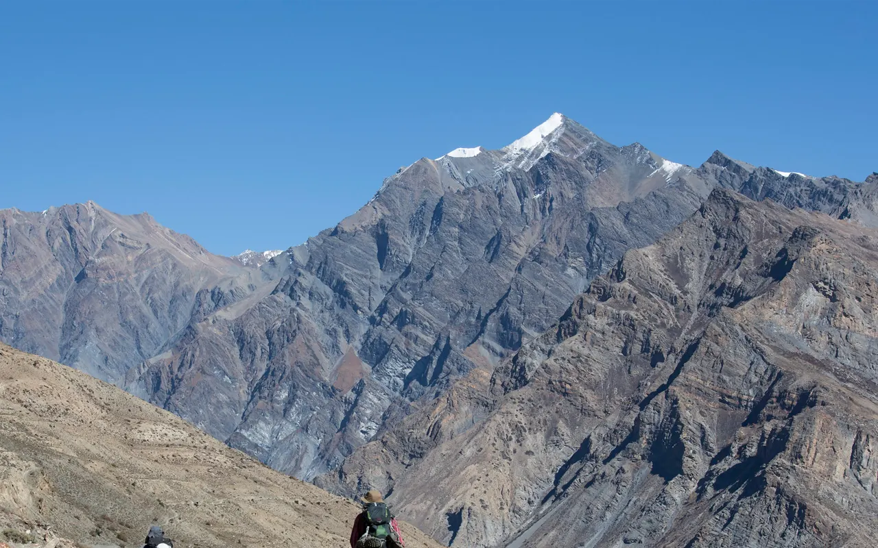
The Lower Dolpo Trek is hard and best for people who have trekked before. On the hardest days you will walk 7–8 hours, tackle substantial ascents, and cross two passes above 5,000 m (Numa La 5,190 m; Baga La 5,070 m). Exercise before the trip for several months. Take walks on hills, stairs, jogging, cycling or swimming. Train with a weighted backpack; improve your core and shoulder strength to cope with uneven terrain. Be prepared for early starts, long days and unpredictable weather. Walk at a steady pace, converse with your guide, drink plenty of water and eat well at each meal. With proper training and attitude a sense of great achievement will be felt during the trek.
Altitude & Acclimatization Plan for 19 days Lower Dolpo Trek
We will climb at a gradual pace and there are planned rest days. Before the high passes, near Dho Tarap (4,090 m), we will acclimatize for one whole day. As much as conditions permit, we will practice “climbs high, sleep low.”
We will walk at a comfortable, steady pace drink water regularly and refrain from alcohol and smoking. Our guide carefully monitor for symptoms of altitude sickness (headache, dizziness or nausea) and if any symptoms are noted, we will immediately reduce pace, introduce rest or descend.
Some trekkers choose acetazolamide (Diamox) to support acclimatization; we kindly recommend discussing this with your healthcare provider in advance to confirm it’s appropriate for you.
Best Season for the Lower Dolpo Trekking
Best times to visit are spring (March-May) and autumn (September–early November). Flights are more reliable and skies are clearerand flights. Dolpo is in a rain-shadow area so early June or late August works fine but flight delays and slippery trails are to be expected. Winter (December – February) is very cold and many passes are snow-covered. This trek is not recommended in winter unless you are an experienced high-altitude trekker.
Tea Houses & Camping
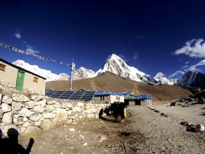
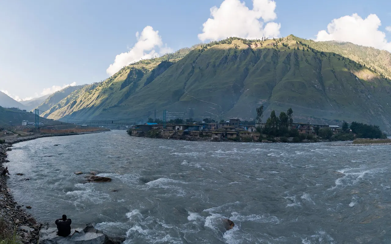
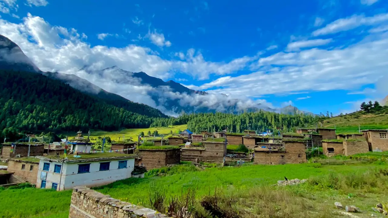
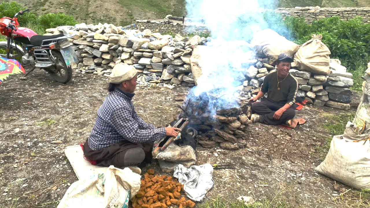
Infrastructure is limited. Unlike Everest or Annapurna, the Lower Dolpo Trek mostly relies on camping. Some villages (e.g. Dunai, Tarakot, Dho Tarap, Ringmo) offer basic teahouses or homestays. Food is mostly just dal bhat, noodles, or potatoes and beds are rather simple. Many nights we camp in expedition tents with sleeping mats and a dining tent. This lets you enjoy remote, beautiful camps. When available, electricity usually comes from solar power. Hot showers are rare, but embracing the simple life is part of Dolpo’s charm.
Transportation & Trail Facilities
Reaching Dolpo typically involves two flights: from Kathmandu to Nepalgunj to Juphal (STOL airstrip). There are strict baggage limits (usually about 10 kg checked + 5 kg hand, varies by airline). It’s possible to drive to Dunai by jeep, but it’s a rough couple of days. Once you’re on the trail, there are no roads. Porters and pack animals carry group gear while you hike with a daypack. Dunai has a small health station and some stores; beyond Dunai there are no ATMs or pharmacies. You will need to boil or filter your drinking water. In brief, once you’re in Dolpo, you’ll have to leave behind the modern luxuries.
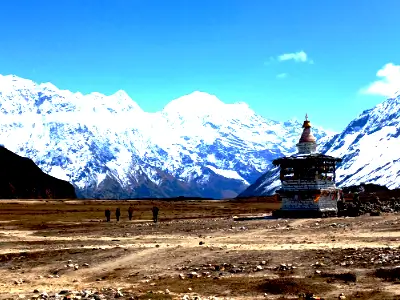
What to Expect on Lower Dolpo Trekking
The trails are often stony and steep, with few other trekkers around. The landscape shifts from canyons and forests to open, windswept alpine valleys. Villages feel timeless, stone houses, yak caravans and living Bon and Tibetan Buddhist traditions. Walk clockwise around chortens and mani walls. Mornings are early; weather can be anything from blustery winds to bright sunshine. Flights can be delayed, so we include a buffer day. The team will adjust plans as conditions change, with safety first.
Guide & Staff
A licensed guide is a must in Dolpo’s restricted areas. The guide leads the trek with the support of porters, camp cook. The guide is in charge of safety, health checks, permits, and logistics and is also familiar with wilderness first aid. The staff handle camping, cooking, and water so you can focus on walking. Many trekkers leave the trek feeling like part of the family.
Is It Beginner‑Friendly?
Generally, no. The trek is lengthy, remote and high altitude, and should be done by trekkers with some experience of multi-day trekking and some altitude exposure. Most people can do it with a well-known operator if they train a lot, take additional rest days, and are fitter than the average person, but those undertaking a solo needs to know that it is a challenge and they are advised to follow the advice in this guide.
Altitude Sickness
Anyone above 2,500 m can experience altitude sickness, but gradual climbs and rest days help minimize the risk. Headache, nausea, dizziness, poor sleep are all early signs to look out for, so be sure to report them. First aid is rest, water and walking slowly. If symptoms worsen we must descend. Guides carry first-aid kits and can use an oximeter. Evacuation plans—usually by helicopter when weather allows—are in place. Insurance coverage with special conditions for high altitude trekking and emergency evacuation is required.
Gadgets, Charging & Internet
Fully charge devices in Kathmandu or Nepalgunj; afterward, charging is rare and only available in a few villages for a fee. There is almost no mobile or WiFi after Dunai. Carry power banks and extra batteries, and consider a small solar panel. Keep your devices warm at night to preserve battery life. We have a satellite phone in case of emergencies.
Permit Essentials & Restricted Area Rules on Lower Dolpo Trek
Lower Dolpo Restricted Area Permit (RAP): USD 20 per person per week, plus USD 5 per person per day after the first week. Issued only through registered trekking agencies and requires a minimum of two trekkers.
Shey Phoksundo National Park Entry Permit: about NPR 3,000 for foreign nationals (SAARC lower).
Carry your passport for check-ups, follow your guide, and stay on designated routes.
Your Extra Expenses
Budget for a Nepal visa (about USD 30–50) and comprehensive insurance that covers high altitude and emergency evacuation. City meals are not included so bring cash for that and snacks and drinks for the trek. It’s common to tip the crew, you may choose the quantity. Set aside a little for delays or having to stay an extra night in the hotel. Gear (sleeping bag, down jacket, etc): available for rent in Kathmandu.
Photo Hotspots & Sunrise Tips
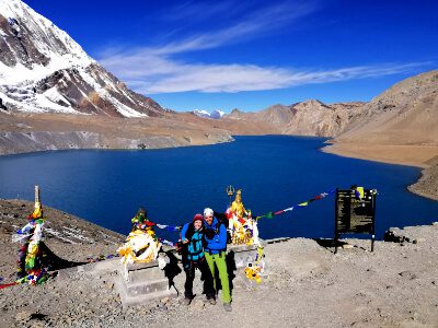
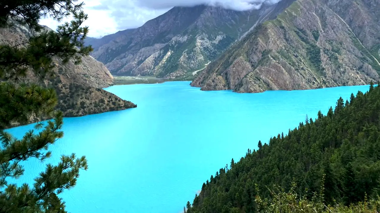
Shey Phoksundo Lake (3,611 m): turquoise water. Shoot from Ringmo’s lakeshore and nearby viewpoints when the light is calm in the morning and at sunset.
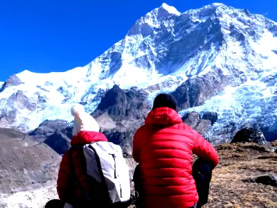
Numa La and Baga La: open ridgeline with Dhaulagiri and trans-Himalayan views. Early morning light is beautiful.
Villages such as Dho Tarap: stone houses, local clothes, yaks. Ask permission before photographing people.
Night sky: camps at high altitude offer amazing views of the Milky Way at night on clear nights. Prepare additional batteries and memory cards as there are a lot of scenes.
Wildlife & Natural highlights on Loder Dolpo Trek
Blue sheep (bharal), Himalayan tahr, musk deer, marmots and such as griffon vultures and golden eagles are present in the largest Shey Phoksundo National Park, Nepal. Snow leopards occur in the park but are rarely seen. In the summer, alpine flowers and medicinal plants develop. The Phoksundo (Suligad) Waterfall 167 m high, cascades from the lake’s outlet and is among Nepal’s tallest.
The cliffs, layered rock formations, and deep gorges like the Tarap Chu showcase impressive geology. While the waters of Phoksundo are ultra-clear with very little to no visible aquatic life. The Phoksundo (Suligad) Waterfall is a 167-m cascade at the lake’s outlet; it is best photographed from Ringmo’s side trails or higher although it can also be viewed on the main trail in an open and bright morning or evening light.

Good to know, before you travel
Want to learn more about this journey in-depth? Essential Trip Information includes a thorough itinerary, information for visa processing, Accommodations, Food , Acclimatization’s and pretty much anything else you could possibly need to know about this tour. Read more inside.
Frequently Asked Question
Spring (Mar-May) and autumn (Sept-Nov) are optimal, for stable weather and clear skies. Monsoon often disrupts flights, and winter is too cold with passes blocked by snow.
It is a difficult journey with long days, altitude and remote trails. You should be already familiar with trekking and be fit.
A Licensed guide is a must. Because Lower Dolpo is a restricted area you cannot trek alone.
Lower Dolpo Restricted Area Permit and Shey Phoksundo National Park Entry Permits are required. A TIMS card is not needed.
Yes, as you cross passes over 5,000 m. We plan rest days and gradual climbs in order to minimize the risk.
You’ll most often be staying in tents, although we will have some simple homestays. Meals are simple but hearty, like dal bhat, noodles and porridge.
Very limited. A few villages are set up with solar energy or have weak mobile signal, but most of the trek is without electricity. Bring power banks.
Guides carry a first aid kit and satellite phone. If the problem is very serious, we arrange an evacuation (often helicopter, weather permitting). Insurance is required.
Warm sleeping bag, trekking boots, layered clothing, waterproof clothing, trekking poles, sun protection, head torch and spare batteries/power banks.
Yes, we can change the Lower Dolpo Trek schedule, adding more rest or sightseeing days to fit your plans.
Quick Inquiry Form
You can talk with our travel experts for departure dates and price details.
- Private trip departures everyday
- No hidden cost
- Local based company
- Over 17 years of experience
- Trip Customization